
The Pirireis Association celebrated its 15th anniversary with its board members and representatives of civil society organisations.
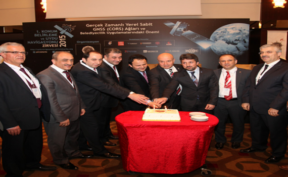
Founded in 2000 to represent its members nationally and internationally in real estate, geographic information systems, surveying, urban transformation, photogrammetry, remote sensing, hydrography, spatial planning, land registry and cadastre, and to work with institutions to develop the sector, the Pirireis Association continues its activities with a growing membership and supporter base. The association celebrated its 15th anniversary with its friends by cutting an anniversary cake at the “1st Positioning and Satellite Navigation Summit 2015”, held at Titanic Business Kartal Hotel on 20 March 2015.
In his opening address at the “1st Positioning and Satellite Navigation Summit 2015”, Pirireis Association President Selami Balcı discussed the historical development of geographic information systems and their importance today. He noted that such conferences increase and accelerate work in the field, saying: “It is extremely important for all societies that navigation summits of this kind are held regularly and that people working in this field come together to discuss and research topics that illuminate our world, such as satellite imagery and the future of astronomy.” After outlining the association’s work and events and its plans for a magazine in the new term, he concluded: “Bringing people from different disciplines together around these subjects is one of our greatest aims. We will continue our efforts to achieve this goal in scientific development, information technology and transformation. To this end, we will take part in the Türkiye Youth Summit in April. I thank all my colleagues working in this field.”